Printify
Ancient Gaul - French 19th Century Map (Museum Paper Print)
Ancient Gaul - French 19th Century Map (Museum Paper Print)
Couldn't load pickup availability
Share
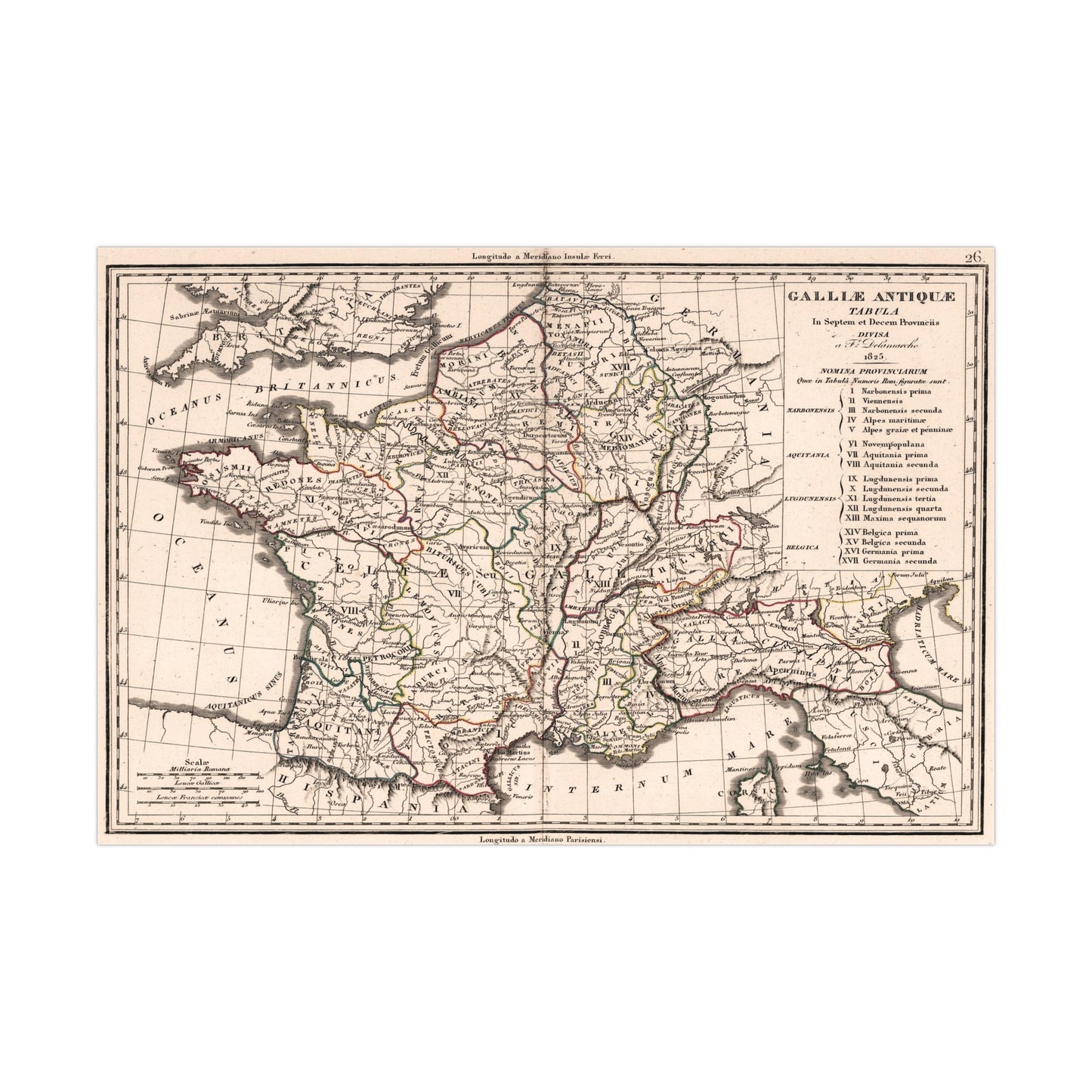
A beautiful antique replica print of a map depicting the ancient provinces of Gaul, in modern-day France, created by Felix Delamarche in 1825 and published in the year 1826 in Paris, France as part of "Atlas De La Geographie Ancienne et moderne, Adopte Par Le Conseil Royal De l'Instruction Publique, A l'usage des Colleges Royaux et des Maisons d'Education, pour suivre les Cours de Geographie et D'Histoire".
This map comes to life in vivid detail & stunning color. Made with fine art paper (175gsm), an industry-standard choice for professional photographers and artists, these posters come in multiple sizes for you to choose and are perfect for indoor use.
.: 175gsm fine art paper
.: Matte finish
.: 7 sizes to choose from
.: Horizontal, vertical and square options available
.: NB! For indoor use only