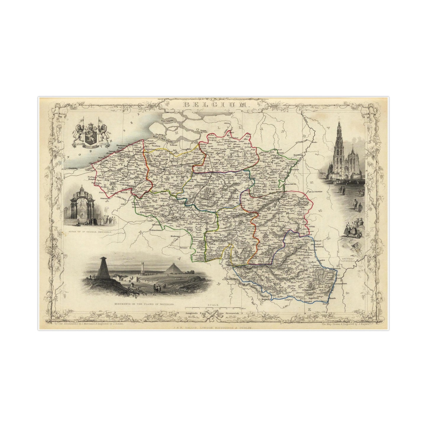
A beautiful antique replica print of an antique map depicting Belgium published by J. & F. Tallis in the year 1851 in New York. The original full title of the map is "Belgium. The Illustrations by J. Marchant & Engraved by J.B. Allen. The Map Drawn & Engraved by J. Rapkin.". Regions shown in full color with drawings of Antwerp Cathedral, monuments at Waterloo, the Belgian crest and the Altar of St. Gudule, Brussels.
This map comes to life in vivid detail & stunning color. Made with fine art paper (175gsm), an industry-standard choice for professional photographers and artists, these posters come in multiple sizes for you to choose and are perfect for indoor use.
.: 175gsm fine art paper .: Matte finish .: 7 sizes to choose from .: Horizontal, vertical and square options available .: NB! For indoor use only