1
/
of
3
Printify
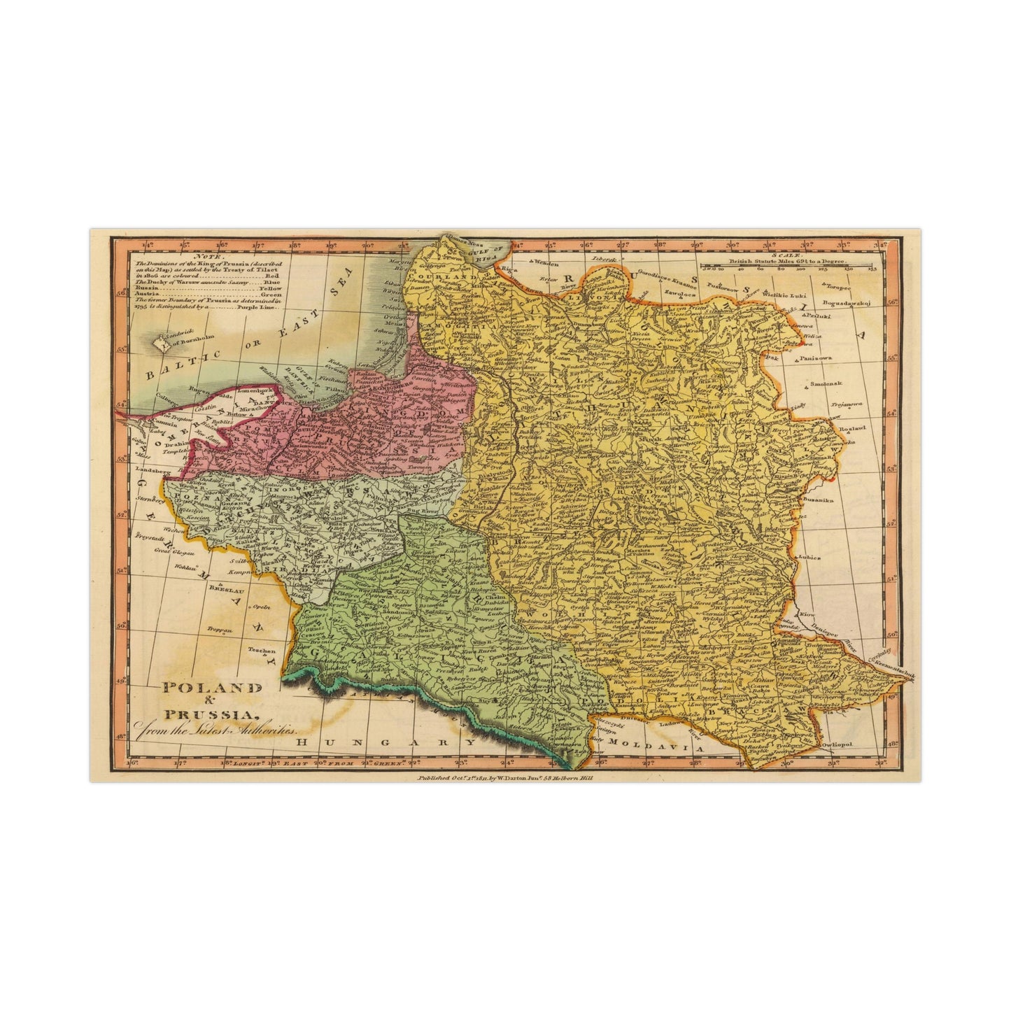
Poland - 19th Century Map (Museum Paper Print)
Poland - 19th Century Map (Museum Paper Print)
Regular price
€7,17 EUR
Regular price
Sale price
€7,17 EUR
Unit price
/
per
Tax included.
Couldn't load pickup availability
Share
A beautiful antique replica print of an engraved and hand colored map depicting the provinces of Poland, Prussia, created by William Darton in 1811 and published in the year 1813 in London. The original title of the map is "Poland & Prussia, from the latest authorities".
This map comes to life in vivid detail & stunning color. Made with fine art paper (175gsm), an industry-standard choice for professional photographers and artists, these posters come in multiple sizes for you to choose and are perfect for indoor use.
.: 175gsm fine art paper
.: Matte finish
.: 7 sizes to choose from
.: Horizontal, vertical and square options available
.: NB! For indoor use only